Software Engineer, Designer and bestselling LEGO® book author
FishMap Robotics
Fish Mapping

Mapping the Lake Bed

FishMap Robotics creates digital twins of water bodies.

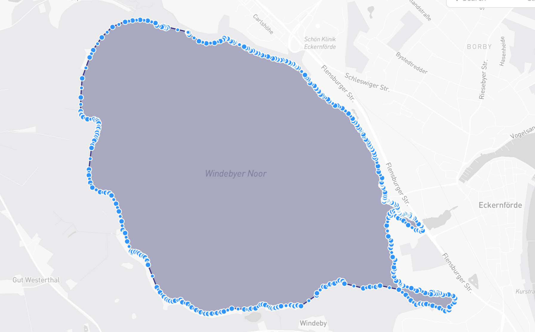
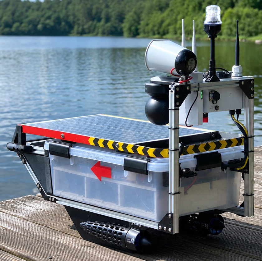
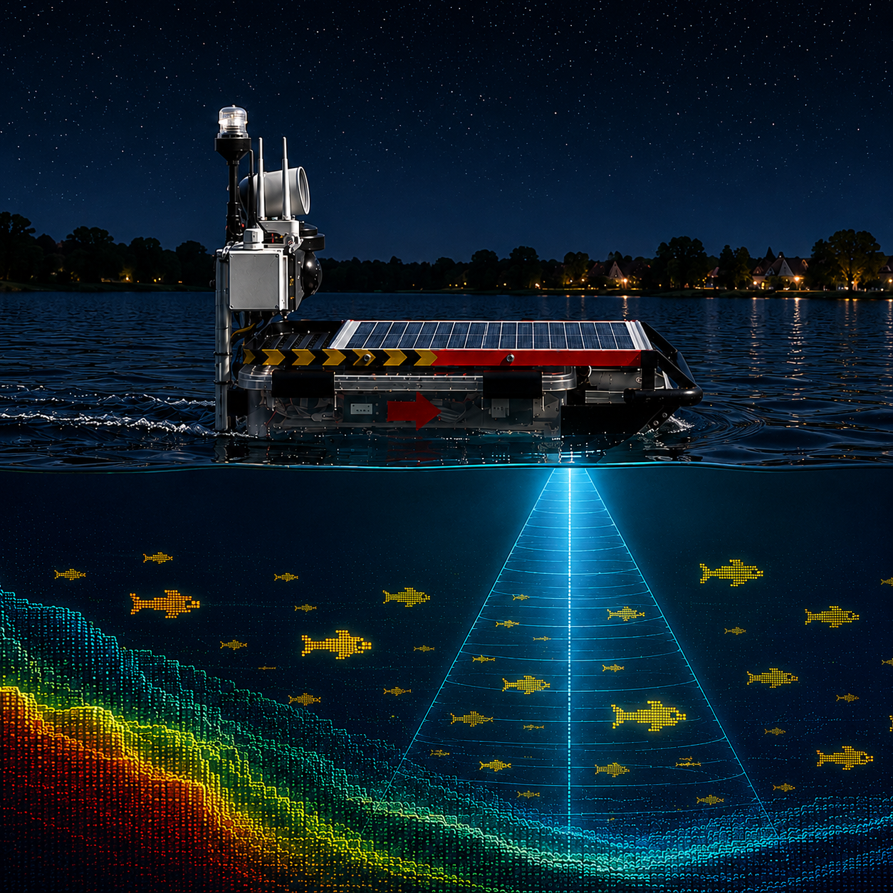
The project develops autonomous drone boats that map lakes, coastal waters and other defined water areas, detect fish activity and monitor the water surface. Once a search area is defined, the drone calculates its own route, covers the area autonomously and continuously streams data from sonar, cameras and onboard sensors to the ground station.

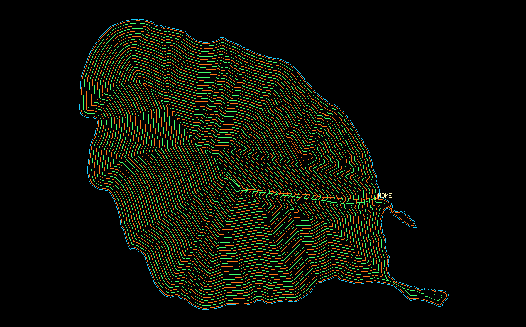
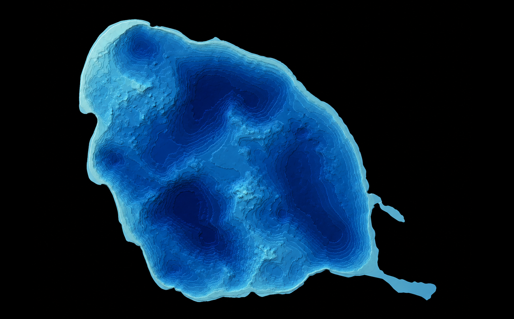
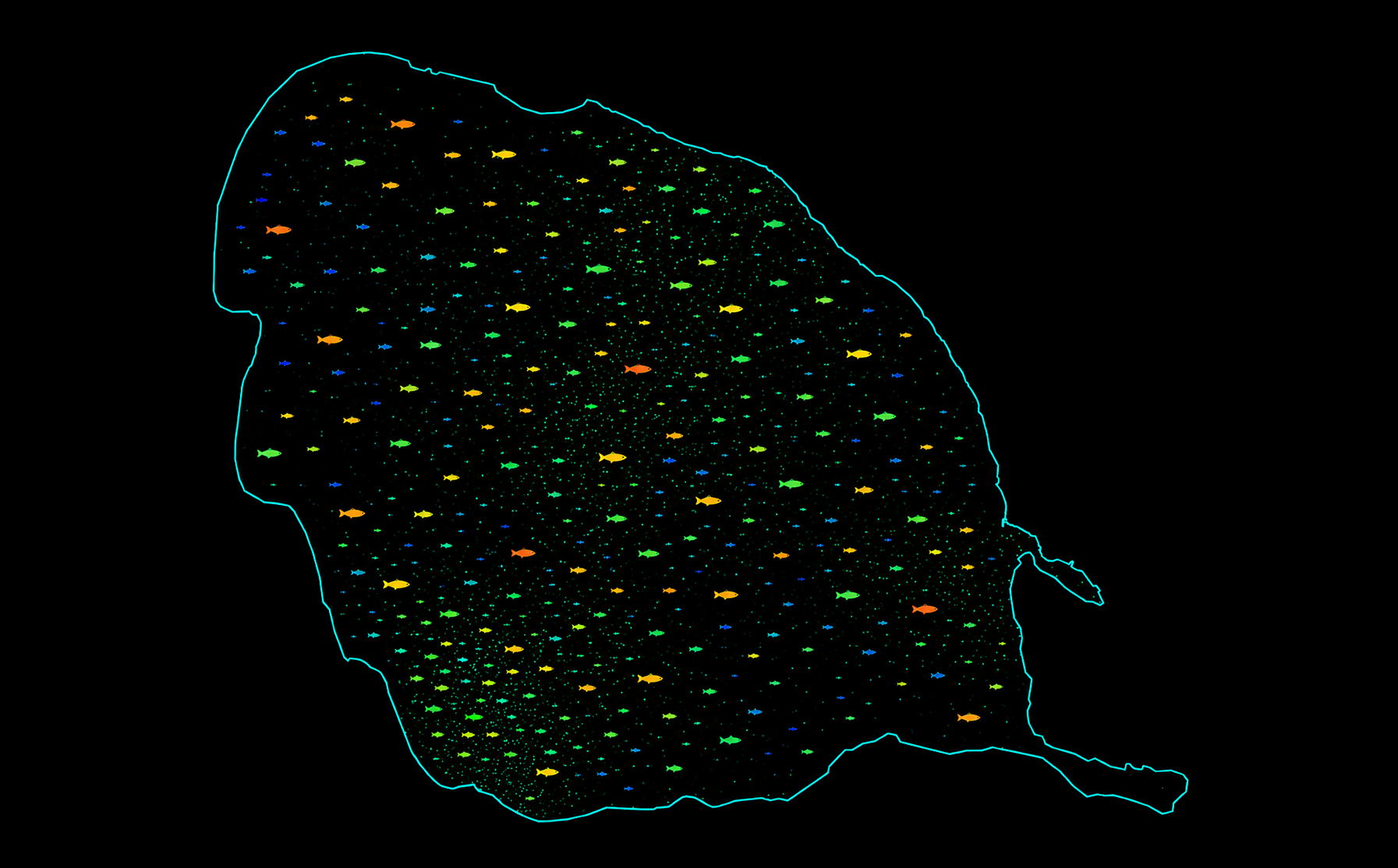
There, the collected data is transformed into a digital twin of the water body. Depth profiles, fish detections, surface activity and environmental data become visible in one shared interface. Instead of working only with experience, assumptions and isolated observations, fisheries gain a dynamic, map-based view of their operating area.

This gives fishery work a new simulation-like dimension: areas can be inspected, compared and revisited digitally, almost like in a strategy or management game – but based on real sensor data from the water.

The system supports fisheries and research institutions in making better decisions, monitoring sensitive areas and protecting fish stocks, for example through surveillance and acoustic deterrence of cormorants.

Features

Workflow: From Mission Planning to Fish Mapping

Search Area Map
Define the Search Area

First, the target area is marked as a polygon on the map by the user. This defines the exact water surface the drone will scan autonomously.

RouteMap
Mission Map
Autonomous Coverage Mission

After the area is defined, the drone calculates its own search pattern and follows it autonomously until the full area is covered.

DepthMap
Depth Map
Underwater Terrain Model

During the mission, the sonar records depth measurements and builds a detailed view of the lake bed.

RouteMap
Fish Map
Locating Fish Activity

Every fish detection is logged with its position and displayed on a live map, giving fisheries a clearer view of where fish are located.

Pingu-1

Image Description

Prototype PINGU-1

PINGU-1 is the first FishMap Robotics prototype: a compact autonomous drone boat for fishery support, sonar mapping and water surveillance.

It is equipped with high-definition GPS, sonar, day and night vision cameras, LTE telemetry, a backup radio link and an acoustic deterrence system. With a 2.7 kWh battery, 30 W solar panel, 23 kg weight, approx. 6 km/h top speed and up to 200 km operational range, Pingu-1 is designed for long-duration autonomous missions on lakes and coastal waters.

© Martin Hüdepohl - All Rights Reserved